Which Old Port Montreal Streets Still Follow Their Original 17th and 18th Century Routes?

Did you know that when you walk down certain streets in Old Port Montreal, you're following paths that were established before Canada was even a country? Some of our neighborhood's routes date back to the 1670s—meaning locals have been using these same corridors for over 350 years. While the cobblestones might be covered in asphalt now and the horse-drawn carriages have been replaced by delivery trucks, the fundamental layout of Old Port Montreal remains remarkably faithful to its colonial origins.
Understanding which streets follow their original historic routes isn't just trivia for history buffs—it helps us make sense of why certain intersections feel oddly angled, why some streets dead-end unexpectedly, and why our neighborhood's layout feels so different from the grid patterns you'll find in downtown or the Plateau. For those of us who live here, these streets aren't museum pieces; they're our daily commute, our running routes, and our paths to the grocery store. Let's look at which Old Port Montreal streets have stayed true to their original courses—and what that reveals about how our community has evolved.
Which Old Port Montreal Street Is the Oldest Surviving Route?
Rue Saint-Paul holds the distinction of being Montreal's oldest street—and yes, it still follows the exact path laid out in 1672. Originally, this route traced the southern bank of the Saint-Louis River (Rivière Saint-Louis), a small waterway that once flowed through what we now call Old Port Montreal. The river was eventually filled in and built over, but the street remains as a ghost of that long-buried watercourse.
Walking Rue Saint-Paul today, you're treading the same ground where Montreal's first merchants set up shop over three centuries ago. The street's gentle curve—unusual in a city known for its rigid grid—betrayed its origins as a riverside path. Look closely at the building lines between Rue Saint-Jean-Baptiste and Rue Bonsecours, and you'll notice how the structures follow the old riverbank's contour.
For locals, Rue Saint-Paul serves as our neighborhood's commercial backbone. Bonsecours Market anchors the eastern end, while independent boutiques and galleries fill the historic storefronts along the route. The street's irregular width and occasional narrow stretches aren't design flaws—they're physical records of property lines established when Montreal was a fledgling fur trading post. When you're dodging crowds with shopping bags near Place Jacques-Cartier, remember that you're navigating a route that predates the country itself.
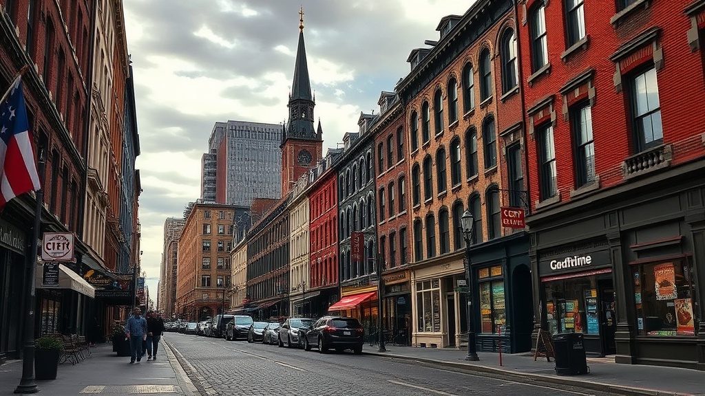
Why Does Rue de la Commune Follow Such an Irregular Waterfront Path?
Rue de la Commune presents a puzzle to anyone new to Old Port Montreal. Unlike the straight boulevards elsewhere in the city, this street zigzags along the waterfront in a seemingly haphazard fashion. There's a reason for this—Rue de la Commune marks the original shoreline of the St. Lawrence River before massive land reclamation projects pushed the water back by several blocks.
When Montreal was founded in 1642, the river lapped at what is now Rue de la Commune. The street's name comes from the French word "commune," referring to the common area along the waterfront where goods were unloaded and stored. As the port grew and wharves extended into the river, the city filled in the spaces behind them—creating new land while keeping the original waterfront street intact.
Today, Rue de la Commune serves as the main artery connecting Old Port Montreal's eastern and western ends. The street's irregular path takes you past the Pointe-à-Callière Museum (built directly atop the city's original foundations), the Clock Tower, and the sprawling Bonsecours Market. For residents, this route offers the most direct walking path between the neighborhood's various districts—though the sharp turns at Rue Saint-Jean-Baptiste and Rue Berri remind us that we're following a 17th-century shoreline, not a modern urban plan.
What Street Connected Old Port Montreal to the Financial District?
Rue Saint-Jacques carries the weight of being Old Port Montreal's western gateway—and it's been performing this role since the 18th century. Originally called Saint-James Street (and still referred to by both names in some contexts), this route established the connection between the waterfront warehouses of the Old Port and the emerging financial district further west.
By the late 19th century, Rue Saint-Jacques had become known as Canada's Wall Street. Banks and financial institutions lined the street west of Old Port Montreal, while closer to the water, the route remained industrial—lined with warehouses and shipping offices that handled the goods flowing through the port. This economic axis shaped our neighborhood's development, creating a corridor where commerce flowed from the ships to the banks.
Walking Rue Saint-Jacques today, you can still read this history in the architecture. Near the Old Port, converted industrial buildings—some with original loading docks and pulley systems—have become residential lofts and creative offices. The street widens as it moves west, transitioning from the intimate scale of the Old Port to the grand boulevard of the financial district. For locals, Rue Saint-Jacques remains a practical route—whether you're cycling to downtown meetings or walking to the metro—but its slope down toward the water follows the same natural grade that 18th-century merchants navigated with horse-drawn carts.
Which Old Port Montreal Street Honors the City's Most Famous Benefactor?
Rue McGill cuts through Old Port Montreal as a north-south artery, connecting the waterfront to the mountain—and it's been doing so since the early 19th century. Named after James McGill, the Scottish merchant whose bequest founded McGill University, this street represents the intersection of Old Port Montreal's commercial history with its educational legacy.
James McGill made his fortune in the fur trade, operating warehouses and shipping operations in the Old Port area. When he died in 1813, his fortune—built largely on trade that passed through these streets—funded what would become one of Canada's most prestigious universities. Naming this street after him acknowledges the economic engine that the Old Port represented in Montreal's development.
The street's route has shifted slightly over the years. Where Rue McGill meets Rue de la Commune, you're standing near the site of McGill's own warehouse operations. Today, this intersection serves as a hub for local residents—within a few blocks, you can access the waterfront promenade, the Science Centre, and the network of smaller streets that make up residential Old Port Montreal. The steep grade of Rue McGill as it climbs north reminds us of the natural topography that existed before the city's extensive grading and leveling projects. For those of us living in the converted warehouses and new developments along this corridor, daily walks up this hill follow the same incline that 19th-century workers climbed after long days on the docks.
What Historic Route Still Serves as Old Port Montreal's Primary Artery?
Rue Notre-Dame functions as the northern boundary of Old Port Montreal—and it's followed this general alignment since the city's earliest days. The street's name references the Notre-Dame Basilica, which stands near the route's western end, but the path itself predates the current cathedral by centuries.
This route developed as a compromise between the waterfront's organic growth and the city's need for a main east-west thoroughfare. While streets like Rue Saint-Paul followed natural features and property lines, Rue Notre-Dame was planned with more intention—though it still had to accommodate existing buildings and land holdings. The result is a street that feels more regular than Rue de la Commune but still retains occasional quirks that hint at its organic development.
For Old Port Montreal residents today, Rue Notre-Dame is practical infrastructure. It's where we catch buses heading east or west, where we find hardware stores and services that cater to locals rather than tourists, and where the neighborhood transitions from historic preservation to contemporary city life. The street's wide sidewalks and consistent building line make it one of the most walkable routes in our area—though the traffic noise reminds us that this isn't just a heritage district, it's a functioning part of a modern city.
Looking at the building styles along Rue Notre-Dame, you can trace the neighborhood's evolution. Near the Old Port, 19th-century stone structures mix with early 20th-century commercial buildings. As you move east, the architecture shifts to reflect different periods of Montreal's growth. The Old Port of Montreal borders this street, serving as a reminder of the area's continued importance to the city's economy. The street's survival as a continuous route—while so many other colonial streets were altered or eliminated—speaks to its importance in the city's transportation network for over three centuries.
Next time you're walking to the grocery store or cycling to meet friends, take a moment to notice the street beneath your feet. In Old Port Montreal, we're not just moving through space—we're traveling through time. These routes have carried Montrealers through the French colonial period, the British era, Confederation, and into the 21st century. The tourists might photograph the buildings, but we locals know the real history lies in the streets themselves—the paths that have defined our neighborhood since the beginning.